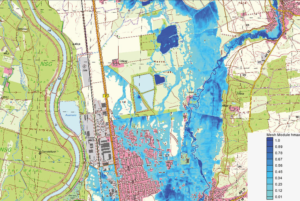
Flood risk mapping, Baden-Württemberg
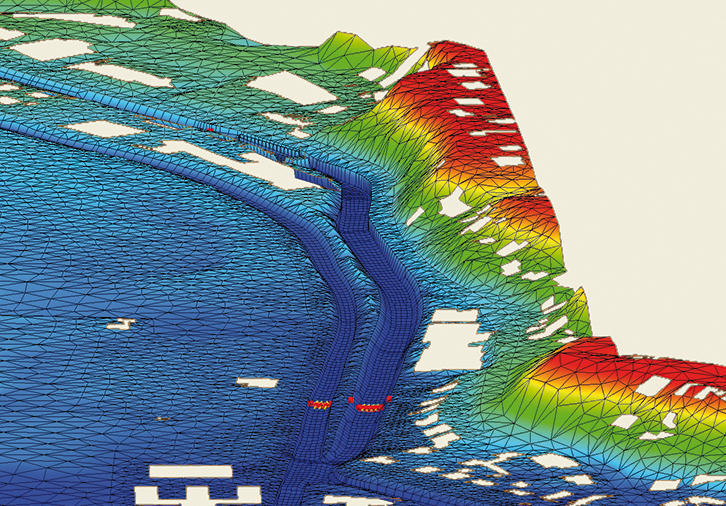
Hydraulic calculations

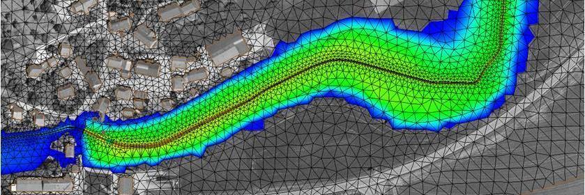
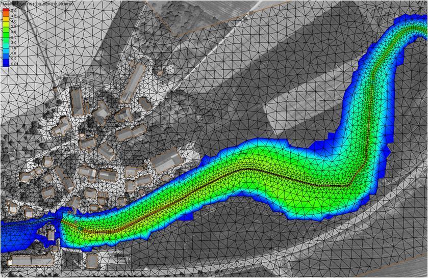
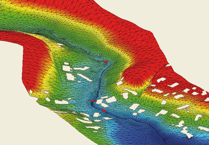
For the creation of flood risk maps in Baden Württemburg, hydraulic calculations were carried out for relevant bodies of water or sections thereof in the Jagst Unterlauf and Mittellauf areas and western feeder rivers of Lake Constance with a total waterway length of 260 km.
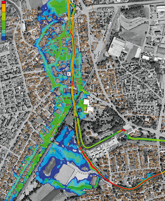
The maps show, among other details, for selected flooding scenarios, the spreading of floodwater with various return periods and flooding depths. The calculations were carried out using a two-dimensional hydraulic model, based on laser scanning data and water body surveys.